
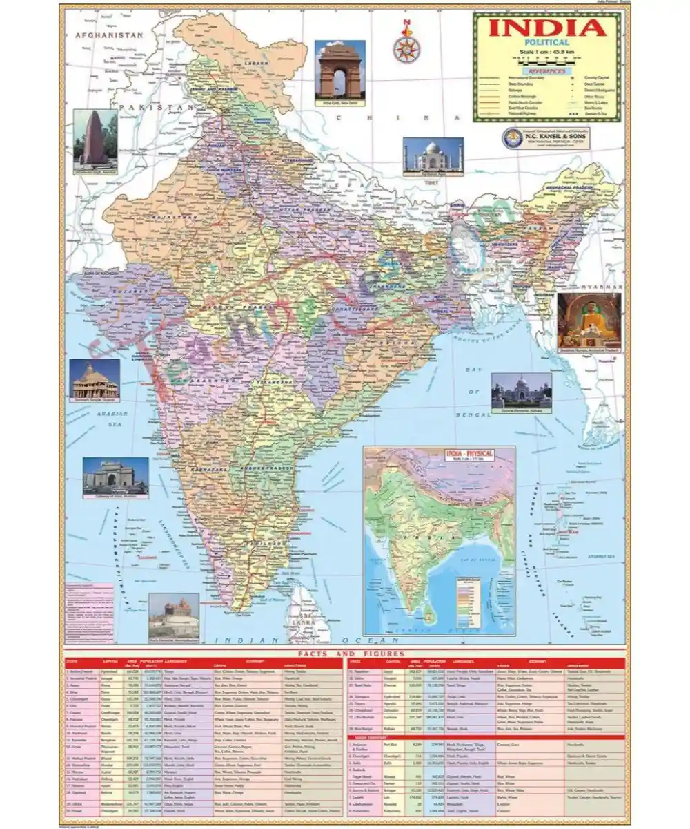


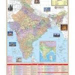
India Political Map is a must-have for all as it shows our country in vivid colors and great detail. The scale and boundaries are highly accurate. It shows administrative boundaries, States & their capitals and major towns, Rivers, Railway network, Road network showing all major national highways, Golden quadrilateral, North-South & East-West Corridors, etc. Brief statistical data of Indian states is given at the bottom. A physical map of India is provided as an inset map.
This India Political Map is a must in all institutes, private and government offices.


Reviews
There are no reviews yet