
Your cart is empty Continue Shopping
 Bones & Skeleton
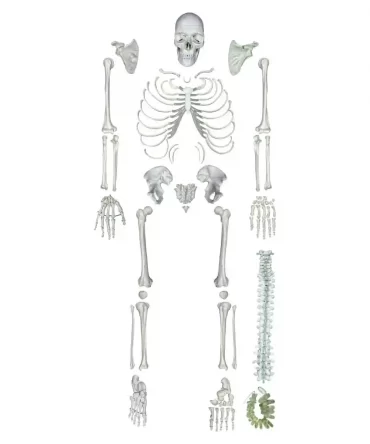
Disarticulated Human Skeleton PVC – Bone Set Model
Original price was: ₹19,079.00.₹8,890.00Current price is: ₹8,890.00.- Human Physiology
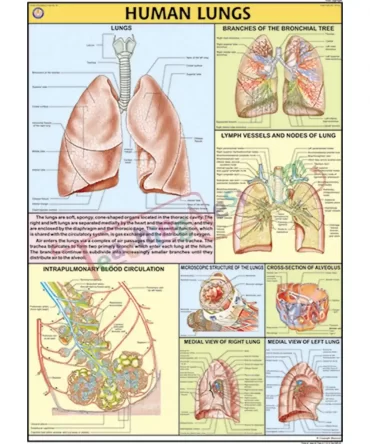
Human Lungs Chart – Synthetic, Wall Sticking
Original price was: ₹389.00.₹245.00Current price is: ₹245.00. - Human Physiology
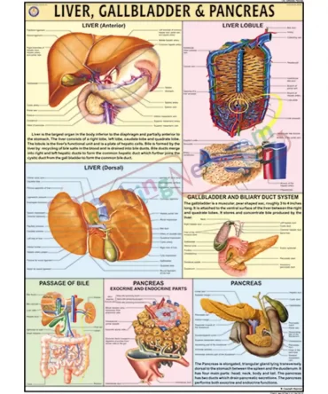
Liver, Gall bladder & Pancreas Chart – Synthetic, Wall Sticking
Original price was: ₹389.00.₹245.00Current price is: ₹245.00. - Human Physiology
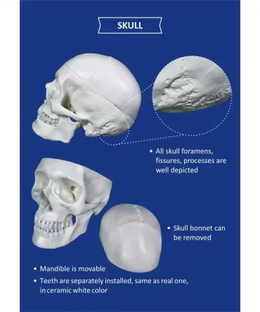
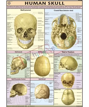
Human Skull Chart – Synthetic, Wall Sticking
Original price was: ₹389.00.₹245.00Current price is: ₹245.00. - Human Physiology
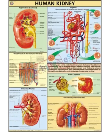
Human Kidney Chart – Synthetic, Wall Sticking
Original price was: ₹389.00.₹245.00Current price is: ₹245.00. - Human Physiology
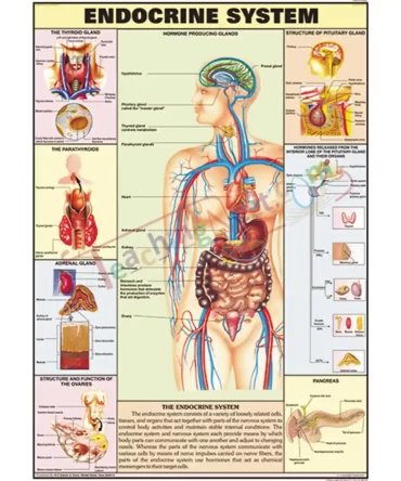
Endocrine System Chart – Synthetic, Wall Sticking
Original price was: ₹389.00.₹245.00Current price is: ₹245.00. - Human Physiology
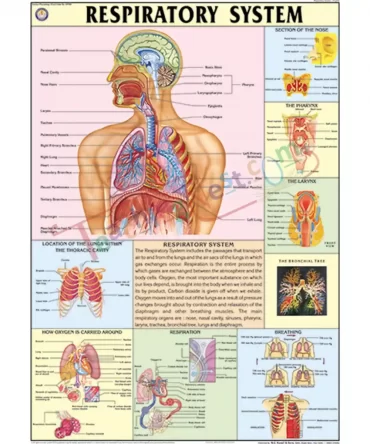
The Respiratory System Chart – Synthetic, Wall Sticking
Original price was: ₹389.00.₹245.00Current price is: ₹245.00. - Human Physiology
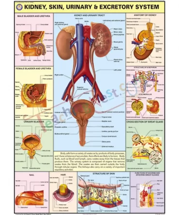
Kidney, Skin & Excretory Organs Chart – Synthetic, Wall Sticking
Original price was: ₹389.00.₹245.00Current price is: ₹245.00.